Features

Everything it does, and nothing it does not

HuntFix is a field tool, not a hunting ecosystem. There is no ballistics calculator, no wind model, no weather, no social feed and no property management. What is here is what serves one question: where was that animal, and how do I get to it?

Sighting

Taking the measurement, in the few seconds you have after the shot.

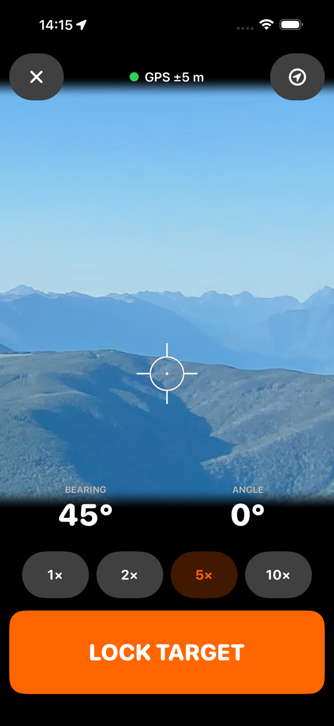
Camera sight with a reticle

The live camera with a centred reticle, so you are aiming the phone at the animal rather than guessing. Zoom runs 1×, 2×, 5× and 10× — the 5× reaches the telephoto lens optically — and the crop is about the optical centre, so the reticle stays on the sight line at every zoom.

Added after a distant target proved unidentifiable at 1×.

Bearing from the device attitude

The bearing comes from the phone's full attitude in a true-north reference frame, averaged over one second, rather than from the raw compass reading. On the phone, that reading held to a couple of tenths of a degree while the ordinary compass value scattered by two degrees.

Elevation angle, two ways

Read from the phone's own sensors, or typed in from a rangefinder that reports inclination, or entered by hand. Whichever you choose is remembered.

An observer position that will not drift

Your position is locked on the first fresh fix when the sight screen opens, and after that only ever improves — a newer fix replaces it only if it is more accurate and consistent with your not having moved. Once you lock the target, nothing replaces it at all.

Warnings that never block you

Poor GPS, a compass the phone does not trust, an uncalibrated magnetometer, an unsteady hand — each is said plainly on the sight screen. None of them stops you locking the target. You are the one standing there; the app's job is to tell you what it knows, not to refuse.

A photo of the sight picture

At the moment you lock the target, HuntFix saves a JPEG of exactly what the reticle was on, at the zoom you were using. Fire and forget — the flow never waits for it — and it is there on the target afterwards, which is often the thing that actually identifies the spot.

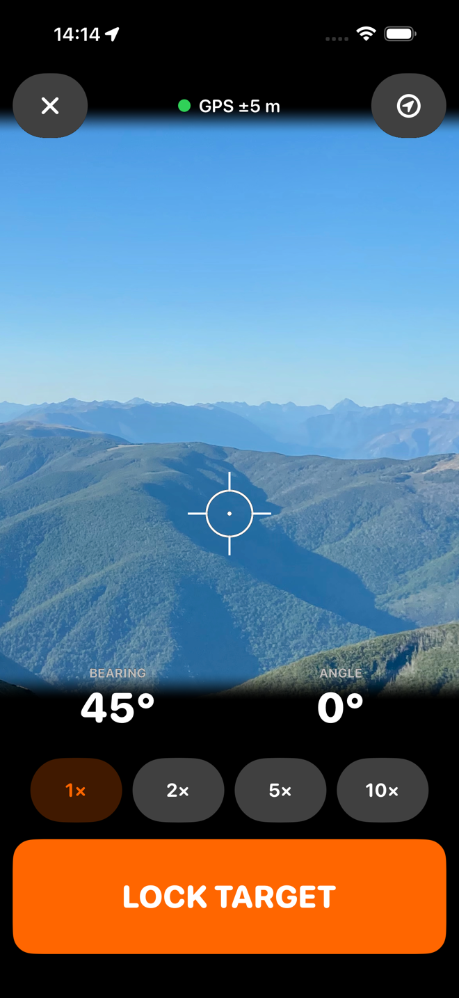
The HuntFix sight screen showing a far face through the camera with a reticle on it.
The sight pictureReticle on the animal, bearing and angle live underneath.
The sight screen at 5x zoom, the far face filling the frame.
Zoom to identify1×, 2×, 5× and 10×. The 5× is the telephoto lens.

Range and calculation

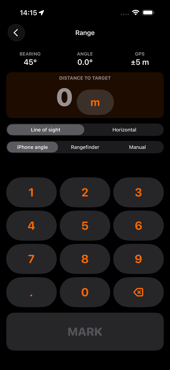
Its own keypad

Big keys, no system keyboard, no autocorrect, usable with cold hands. Metres or yards, switched on the spot and remembered.

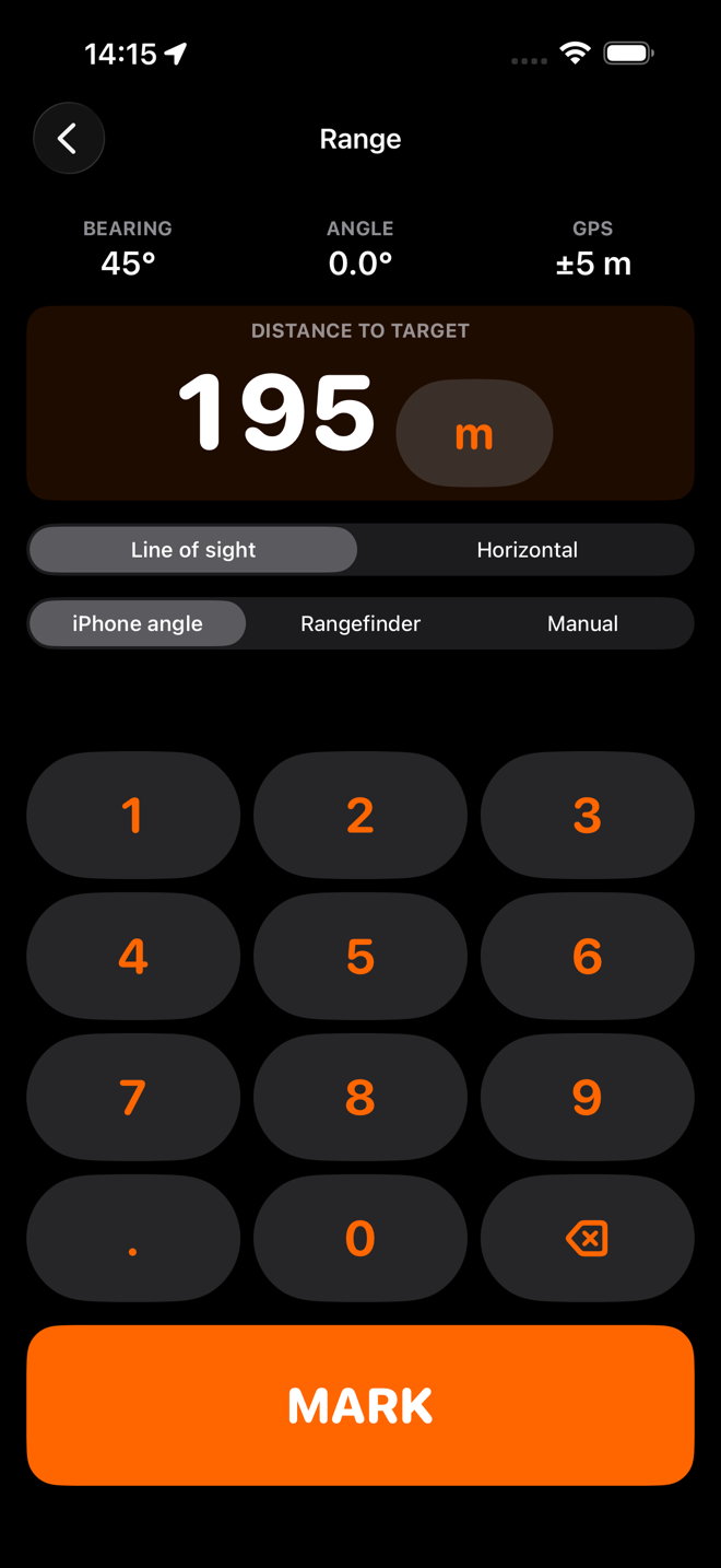
Line of sight or horizontal

Rangefinders differ: some give the straight-line distance, some already correct it for the angle. HuntFix asks which yours gave you and explains why in one line, so the correction is never applied twice.

Proper geodesy

Marking a target is waypoint projection — what a surveyor calls the direct geodetic problem, and what a Garmin calls Project Waypoint. The coordinate is solved with Vincenty's direct formula on the WGS84 ellipsoid, with a spherical fallback used as a cross-check. Verified against a published survey baseline to two centimetres over fifty-five kilometres, and round-tripped from the equator to Svalbard and across the dateline.

Errors, refused rather than absorbed

Zero, negative, absurd and impossible inputs are rejected with a message that says what is wrong. Nothing is silently coerced into a number that would produce a confident, wrong target.

Uncertainty, propagated

The GPS error, the compass confidence, the angle confidence and the steadiness of your hold are carried through the calculation, horizontal and vertical kept separate, and come out as the size and shape of the area to search.

Honest elevation

If the phone had no trustworthy altitude for where you were standing, it cannot know the altitude of the target either. In that case the app shows the relative height difference and a dash for the absolute figure, with a line saying why.

The range entry screen with a large numeric keypad.
Its own keypadNo system keyboard, no autocorrect, cold hands.
The range screen with 195 m entered and the range-type switch above the keypad.
Line of sight or horizontalSo the angle is never corrected twice.
The details panel showing range, bearing, angle, both coordinates and the accuracy broken into across and along the line.
The whole workingEvery input, every output, and the error split in two.

Confirm and save

The confirmation map

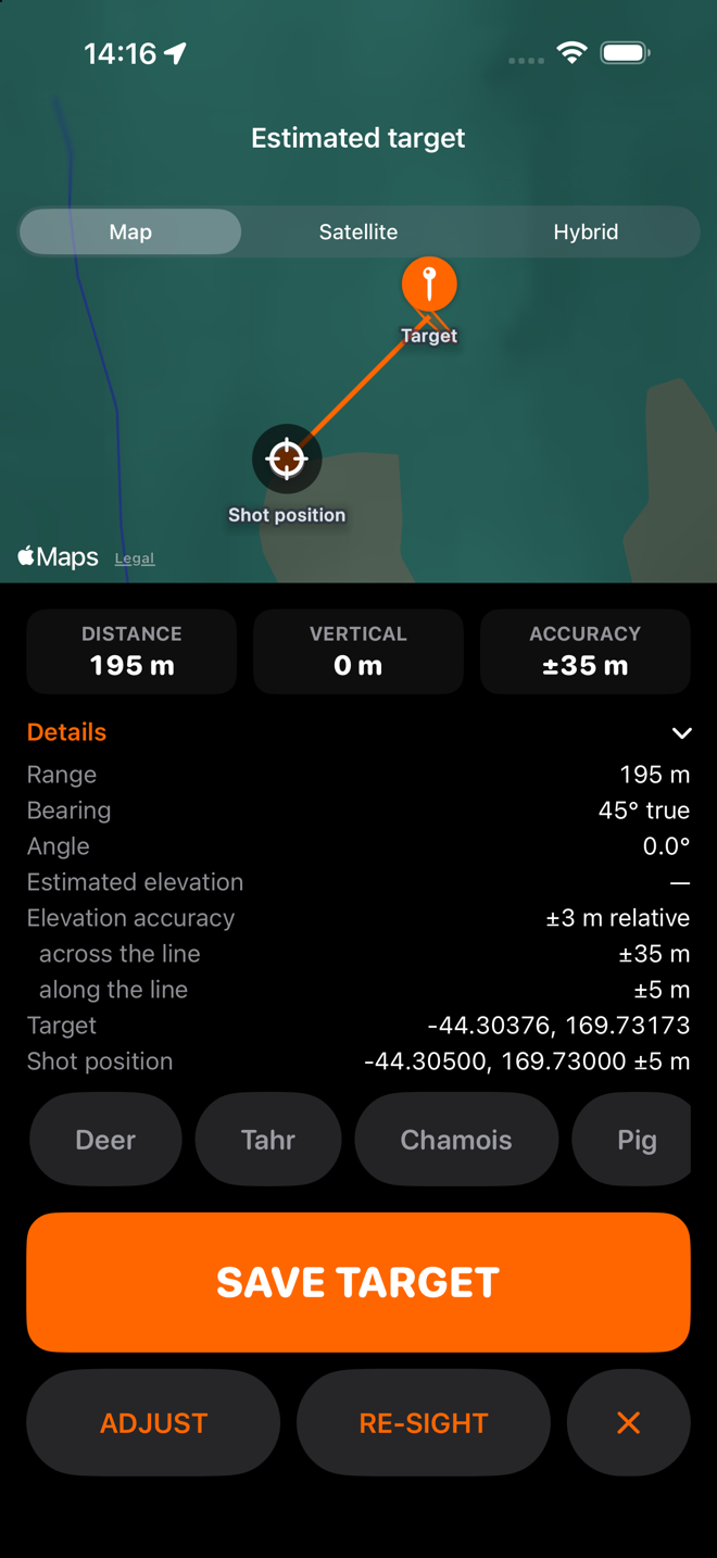
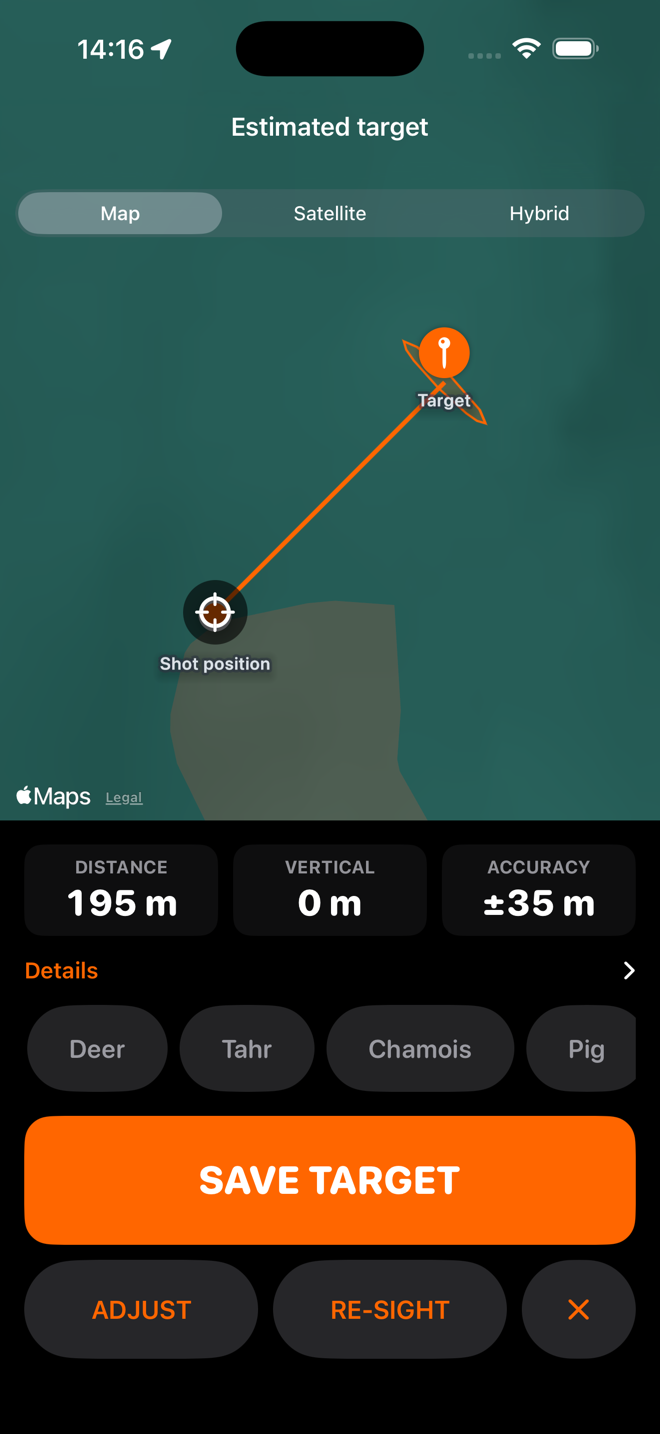
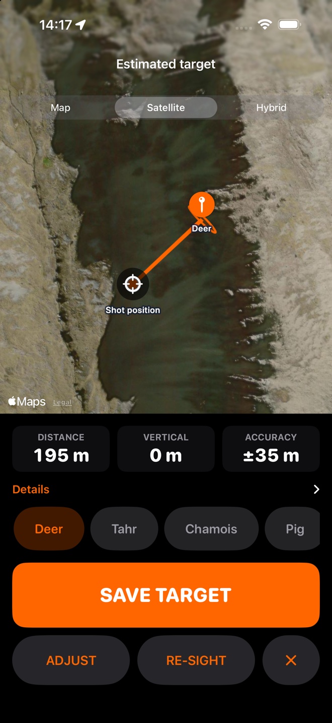
Your shot position, the target, the line between them and the uncertainty drawn as an ellipse — wider across the line of sight than along it, because that is the shape a bearing error actually makes. Map, Satellite or Hybrid.

The full breakdown

Range, bearing, angle, elevation, both coordinates, and the accuracy split into across-the-line and along-the-line. Nothing is hidden behind a paid tier.

Adjust without overwriting

If you can see on the map that the animal is on the other side of the creek, drag the map under the pin and set it there. The adjusted position is stored beside the calculated one, never over it, and the record shows how far it moved.

Quick labels

Deer, tahr, chamois, pig and the rest — one tap, optional, and the pin takes the name.

Re-sight

Got it wrong, or want a second measurement? Re-sight starts a new sighting rather than editing the old one. What was measured stays measured.

The shot position too

Where you took the shot from is saved as its own waypoint. You can navigate back to it as easily as to the animal — useful when you left a pack, and useful when you want to re-sight from exactly the same place.

The confirmation screen with a map, the line to the target and the distance, vertical and accuracy tiles.
Before you keep itShot position, target, and the zone to search.
The confirmation screen on satellite imagery with the target labelled Deer.
Satellite, and a nameUsually the view that tells a hunter something.

Navigation

Numbers first, map second

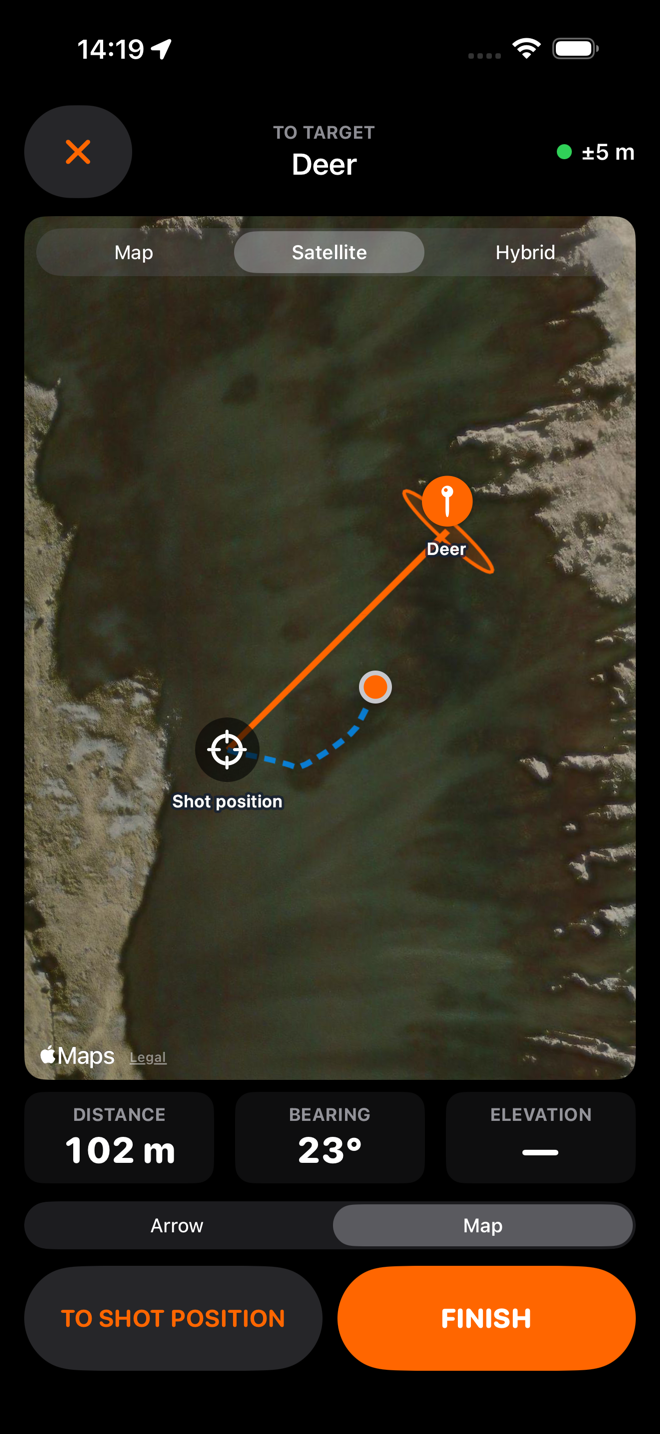
A big arrow and a big distance are the primary display. The map is secondary and is allowed to be blank — out of reception the app still knows everything it needs to.

An arrow that admits it does not know

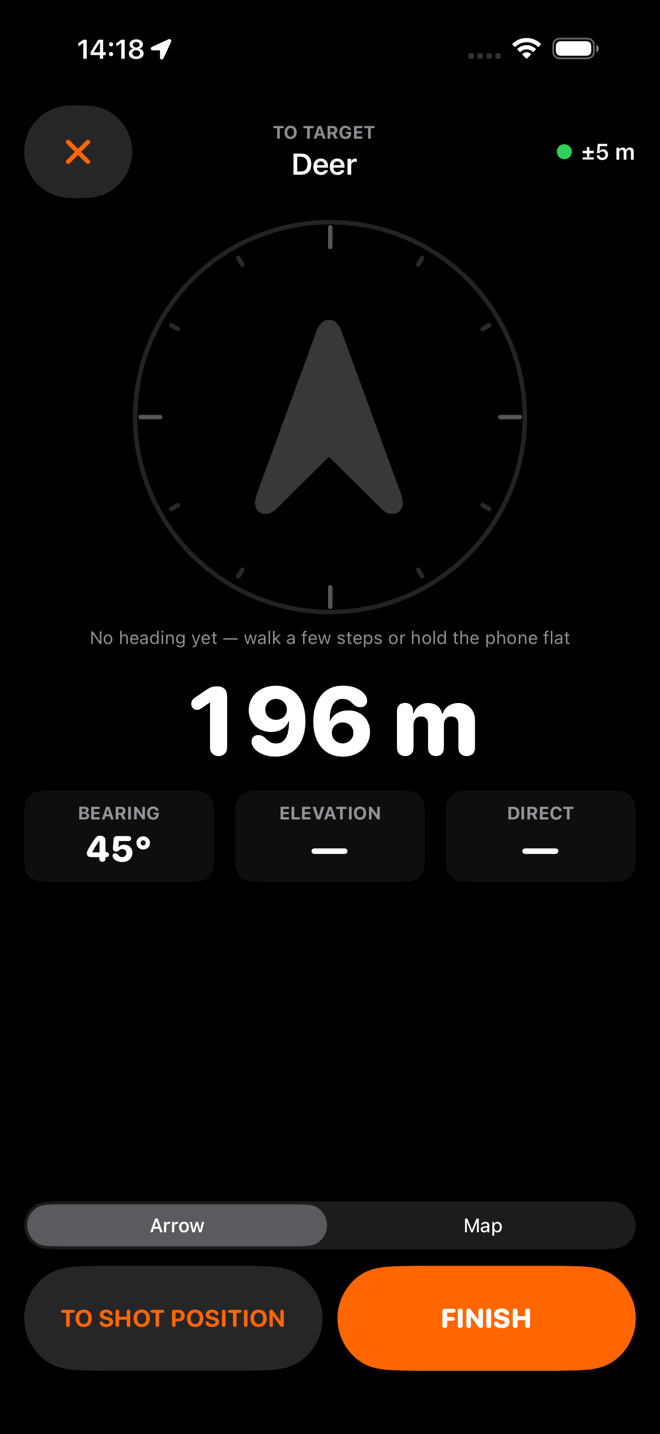
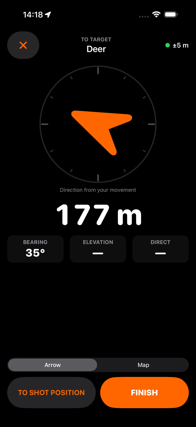
Direction comes from your GPS course when you are actually moving, and from the compass when you are not. When there is no trustworthy heading at all, the arrow goes grey and says so rather than pointing confidently at nothing.

No "wrong way"

Valley navigation means contouring, sidling and backtracking. The app never tells you that you are going the wrong way, because it does not know the country. The distance going up is shown as a bigger number and nothing else.

Near-target mode

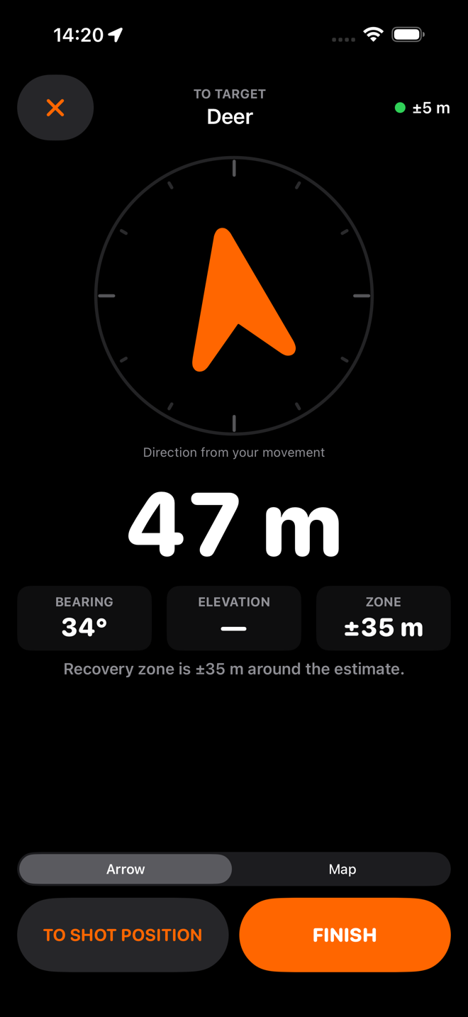
Inside a hundred metres the distance grows on screen, and the third tile becomes the radius of the zone you should be searching — your target's uncertainty combined with your current GPS accuracy. A line tells you plainly when you are inside it.

Breadcrumbs

Every five metres or so while the navigation screen is open, so the route you actually walked is on the map — which matters most on the way back out, in the dark, with weight on your back.

Haptics you can feel through a glove

A tap when you come into alignment, and a distinct buzz at 100, 50 and 20 metres. The alerts fire once and re-arm only if you go well back out again, so they never nag.

The screen stays on

While you are navigating, the phone does not sleep in your hand.

Finish the way it went

Recovered, Not found, or keep it active and come back tomorrow. The record is yours; the app does not judge it and — deliberately — does not charge differently for it.

The navigation screen with a grey arrow and a note that there is no heading yet.
No heading yetGrey, and it says so, rather than pointing at nothing.
The navigation screen with an orange arrow and the distance to target.
MovingDirection from your GPS course once you are walking.
The navigation map on satellite imagery with a dashed breadcrumb trail.
The route you walkedBreadcrumbs every five metres, for the way out.
The navigation screen inside a hundred metres showing the recovery zone radius.
Near-target modeThe third tile becomes the zone to search.

The record it keeps

Every target, with its whole story

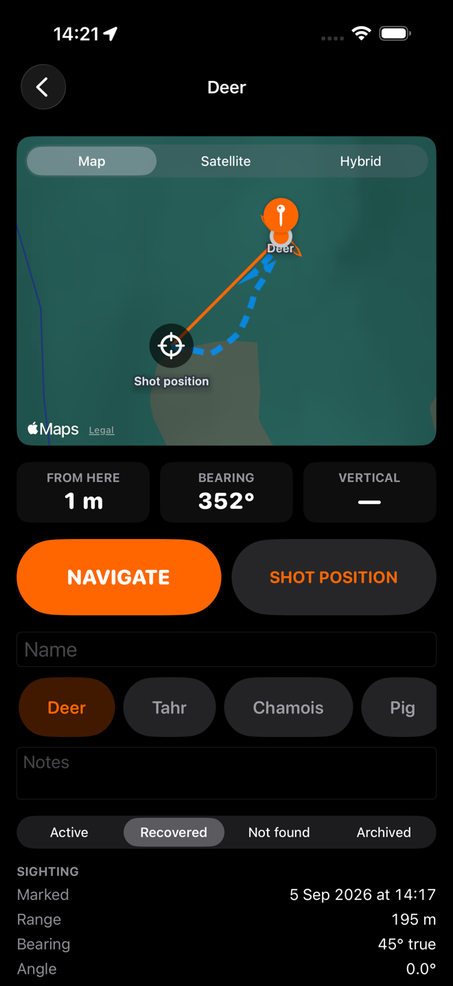
The sighting as measured, the solution derived from it, the photo, the trail you walked, the status, your notes, and the accuracy breakdown. Kept indefinitely, on your phone.

Get it out again

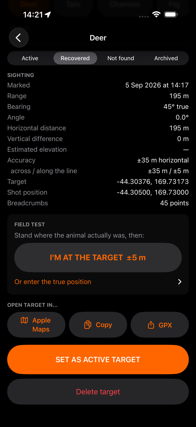
GPX export with the target, the shot position and the track. Open in Apple Maps. Copy the coordinates. No lock on any of it.

Check the app against the truth

Stand where the animal actually was and tap I'm at the target, or type the true position in. HuntFix then shows the miss distance and the bearing, distance, angle and vertical errors against what it calculated — and a summary across every test, exportable as CSV.

This is the tooling that turns "how accurate is it?" into a measured answer instead of a claim.

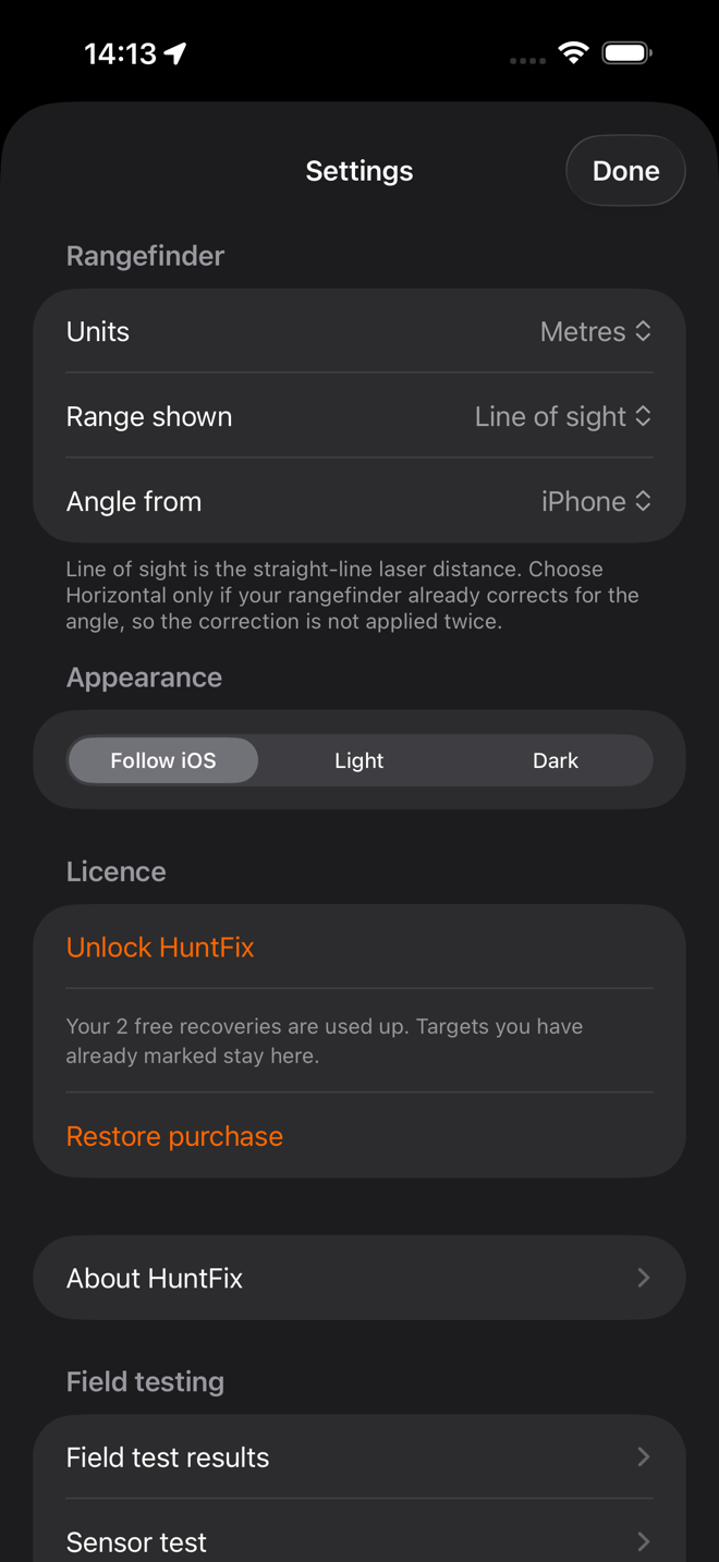
Settings worth having

Units, range type and angle source defaults; light, dark or follow iOS; and a sensor screen that shows every bearing and angle source side by side with its one-second mean and spread, with a HOLD button that freezes the whole panel so a reading can be written down.

The target detail screen with a map and the route walked.
Every targetMap, trail, status, notes — kept as long as you want it.
The lower half of the detail screen showing the sighting record and the export buttons.
And the working under itThe sighting as measured, and the exports.
The HuntFix settings screen.
Set onceUnits, range type, angle source, appearance.

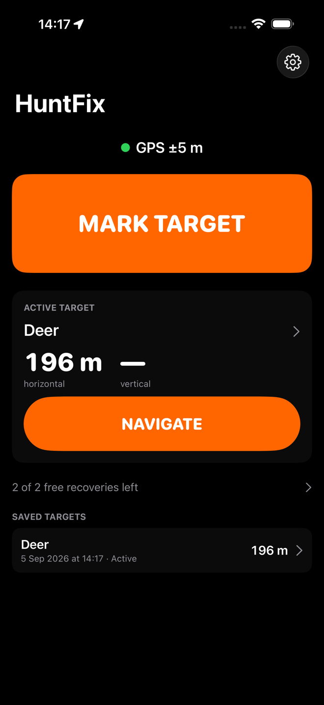
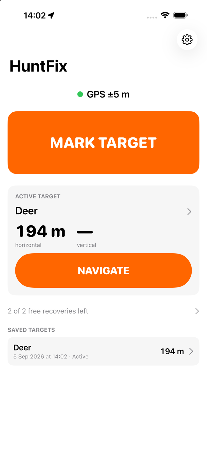
Light or dark, whichever the hill needs

Dark keeps your night vision on a pre-dawn climb. Light is easier to read with the sun straight on the screen. HuntFix follows iOS, or you can pin it either way in Settings — and the walkthrough on this site lets you see both.

The HuntFix home screen in dark appearance, showing an active target called Deer at 194 metres with a NAVIGATE button.
Dark
The same HuntFix home screen in light appearance.
Light

See every screen, in either appearance →

What is deliberately not here

Some of this may come later. None of it comes before the app does the one thing well.

Not in the app

Ballistics, wind, weather, shot placement, route planning, live tracking, social features, property management, and any kind of account.

Possible later

Triangulating a target from two sightings; terrain intersection using an elevation model; Bluetooth rangefinders that send the range across on their own; KML export; an Apple Watch face for the arrow.

Would be sold separately

Anything with a running cost behind it — premium topographic maps, terrain elevation data, cloud backup, sharing targets with a hunting party. If those are ever built they will be offered on their own terms, and they will never take away anything already bought.